دين صانع الخرائط
أمضت إلينور فانس خمس عشرة سنة في تحويل فوضى العالم إلى خطوط منتظمة. وكانت بصفة她是 senior cartographer في معهد بريستول الجغرافي، تعتقد أن فن رسم الخرائط كان في جوهره فعلاً من التواضع—إقراراً بأن الأرض كانت دائماً تعرف أفضل من الخريطة. كانت على وشك أن تتعلم كم كانت مخطئة بعمق.
وصل الأطلس في صباح نوفمبر الرمادي، ملفوفاً في صحيفة من عام 1847، تفوح منه رائحة عفيفة من العفن والأسرار.だったが、 note المكتوبة بخط عجوز متشابك الشر这台解释說، كانت المرأة جارة خالة إلينور الكبرى، وأن الأطلس كان في العلية الخاصة بها منذ زمن الحرب. "على شخص يفهم الخرائط أن يمتلك هذا،" اختتم الرسالة. "لقد سبّب متاعب كافية."
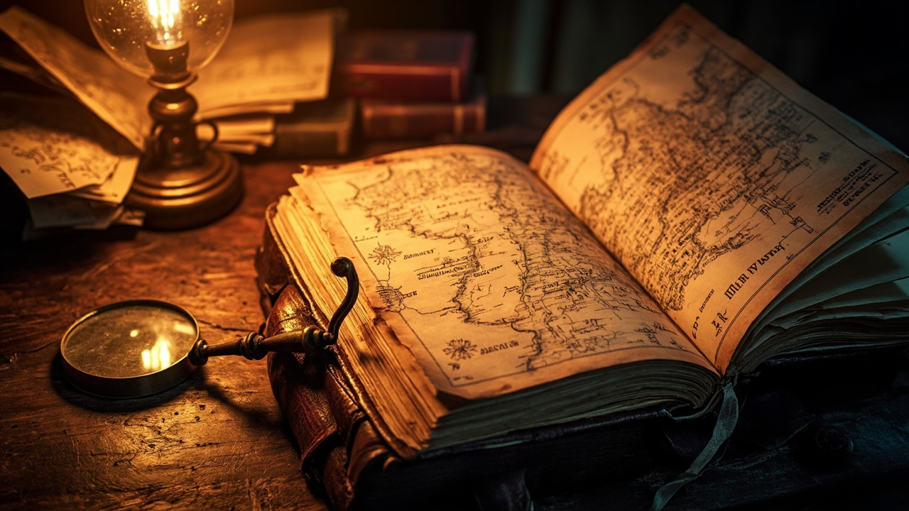
فردّت إلينور الأطلس على طاولة عملها بما يليق من تقديس قد يReservedه آخرون للأغراض الدينية. وعلى غلافه شعار لم تتعرف عليه، وعندما فتحته، كانت الصفحة الأولى تحمل تاريخاً: 1587. وكانت الخرائط بداخله رائعة—مرسومة باليد، ملونة بدقة، تصور المقاطعات الغربية بدقة تتحدى عمرها. لكنها لم تكن جمالها ما أوقفها. بل كان الخط الحدودي.
وفقاً لهذا الأطلس، كان الحد الفاصل بين غلوسسترشاير وسومرست يمر على بُعد ثلاثة أميال شمالاً من كل الخرائط الحديثة. وكانت الآثار مذهلة. مزارع، قرى بأكملها، ربما مئات من صكوك الملكية—الأسس القانونية لحياة الناس—كانت تستند إلى خط اقترح هذا المستند أنه كان خاطئاً جوهرياً.
خلال أسبوع، انتشرت أخبار اكتشافها خارج جدران معهدها المبطنة بالبلوط. وأبدت Society الآثارية في سومرست اهتماماً حذراً. ودعت مجلس المقاطعة إلى جلسة طارئة. ثم وصل ماركوس وايتمور.
كان وايتمور يمثل مؤسسة وايتمور، وهي منظمة أمضت عقوداً تدافع عمّا أسماه "مساسمة الحدود المرسومة منذ القدم." وكان طويلاً، رمادي الشعر، يحمل نفسه بيقين رجل لم يثبت خطؤه قط. "هذا الأطلس،" قال، وأقلّب صفحاته بضيق بالكاد خفي، "من المؤكد تقريباً أنه مزوّر. أو على الأقل، شذوذ. لقد عُيّنت حدودنا منذ قرون."
"الحد الذي أنظر إليه عُيّن بواسطة مساحين من التاج في عام 1844،" ردت إلينور، حافظة على صوتها المتوازن. "لكن هذا الأطلس يسبق ذلك بأكثر من مئتين وخمسين سنة. إذا كان أصلياً، فهو يشير إلى أن الحد الحديث كان دائماً تقريباً—تخميناً متنكراً في ثوب الدقة."
تشنّمت فك وايتمور. "وماذا يُرجى من قلب مثل هذا التخمين؟ الفوضى، الآنسة فانس. فوضى قانونية. ستنخفض قيمة الممتلكات. ستخسر العائلات حقوقها في الأرض." leaning forward. "بعض الحدود توجد بالضبط لأن شخصاً ما، في وقت ما، اتخذ قراراً برسم خط والتمسك به. suggestion خلاف ذلك هو دعوة للفتنة."
بعد أن غادر، عادت إلينور إلى الأطلس. enthalten margins contained notes in cramped Latin، وبينما فحصتها عن كثب، برز اسم: Henricus Whitmore، صانع الخرائط لمستعمرات جلالتها، 1585-1612. فحصت شعار العائلة مقابل سجلات مؤسسة وايتمور. وافق.
كشفت أبحاثها في الأسابيع التالية تاريخاً مزعجاً. لم يكن Henricus Whitmore قد مسح المقاطعات الإنجليزية فحسب—بل كان له دور instrumental في رسم خرائط مستعمرات فيرجينيا المبكرة. habían borders التي عزلت الشعوب الأصلية، أعادت رسم الأمم، وبررت الفظائع. وهنا، في بلده الأصلي، كانت نفس اليد قد رسمت خطوطاً ستشكل حياة الإنجليزية لقرون.
السؤال الذي استهلك إلينور لم يكن ما إذا كان الأطلس أصلياً—فهو كان كذلك Almost certainly—بل ماذا تفعل بالكشف. يمكنها نشر نتائجها، وإشعال معركة قانونية، ومشاهدة مؤسسة وايتمور تنفق الملايين لتدمير مصداقيتها. أو يمكنها التزام الصمت، كما فعل كثيرون قبلها من صانعي الخرائط، والسماح لل fiction المريحة بالاستمرار.
فكرت في جارة خالتها الكبرى، التي أرسلت الأطلس إلى شخص قد يفهمه. "لقد سبّب متاعب كافية." ربما المتاعب لم تكن Truth itself، بل الرفض الاعتراف بها.
نشرت إلينور نتائجها في الربيع. كانت المعارك القانونية التي تلت وحشية ومستمرة. لكن في النهاية، حكمت لجنة مشتركة بأن أطلس 1587 يمثل دليلاً تاريخياً قوياً على حدود سابقة. تم إجراء تعديلات، ودُفع تعويضات، و تراجعت نفوذ مؤسسة وايتمور بشكل ملحوظ.
تواجهها ماركوس وايتمور خارج المعهد في اليوم الذي صدر فيه الحكم. "لقد حطمت شيئاً ثميناً،" قال. "اليقين. فكرة أننا نستطيع معرفة مكانتنا."
تأمّلت إلينور في هذا. "Perhaps هذا هو الموقف الصادق الوحيد،" ردت. "لا نستطيع أبداً معرفة مكانتنا بالضبط. نستطيع فقط رسم خطوط ونأمل أنها تقترب من شيء حقيقي. لكن التظاهر بأن تلك الخطوط كانت دائماً موجودة—بأنها كانت دائماً صحيحة—هذا هو fiction الحقيقي."
مشت إلى البيت عبر شوارع المساء، منتشرة حولها المدينة في كل واقعها الفوضوي المتفاوض عليه. كل حد رسمه إنسان كان، في النهاية، اختياراً. والاستراتيجيات يمكن question، تحدي، إعادة رسم. وليس دين صانع الخرائط تجاه الماضي، ولا تجاه الأقوياء، بل تجاه Territory itself—نحو حقيقة الأرض العنيدة irreduktibel."
كان دين صانع الخرائط ليس تجاه الماضي ولا تجاه الأقوياء، بل تجاه الإقليم نفسه—نحو الحقيقة العنيدة غير القابلة للاختزال للأرض.
Die Schuld des Kartographen
Eleanor Vance hatte fünfzehn Jahre damit verbracht, das Chaos der Welt in ordentliche Linien zu verwandeln. Als leitende Kartographin am Geographischen Institut in Bristol glaubte sie, dass Kartographie im Kern ein Akt der Demut war—ein Eingeständnis, dass das Land immer besser wusste als die Karte. Sie war dabei zu lernen, wie zutiefst unrecht sie gehabt hatte.
Der Atlas kam an einem grauen Novembermorgen, in eine Zeitung von 1847 gewickelt und schwach nach Schimmel und Geheimnissen riechend. Eine beiliegende Notiz, in einer spindeldürren alten Frauenhand geschrieben, erklärte, dass die Frau die Nachbarin von Eleanors Großtante gewesen war und dass der Atlas seit dem Krieg auf ihrem Dachboden gelegen hatte. „Jemand, der sich mit Karten auskennt, sollte dies haben“, schloss die Notiz. „Es hat lange genug Ärger verursacht.“
Eleanor breitete den Atlas mit der Ehrfurcht über ihren Arbeitstisch, die andere vielleicht für religiöse Relikte aufbewahren würden. Das Cover trug ein Wappen, das sie nicht erkannte, und als sie es öffnete, trug die erste Seite ein Datum: 1587. Die Karten darin waren exquisit—von Hand gezeichnet, delikat koloriert, stellten die westlichen Grafschaften mit einer Genauigkeit dar, die ihr Alter Lügen strafte. Doch es war nicht ihre Schönheit, die sie fesselte. Es war die Grenze.
Diesem Atlas zufolge verlief die Grenze zwischen Gloucestershire und Somerset drei Meilen nördlich von dem, wo jede moderne Karte sie platzierte. Die Implikationen waren gewaltig. Bauernhöfe, ganze Dörfer, vielleicht Hunderte von Eigentumsurkunden—die rechtlichen Grundlagen des Lebens der Menschen—ruhten auf einer Linie, die dieses Dokument als grundlegend falsch erscheinen ließ.
Innerhalb einer Woche hatte sich die Kunde ihrer Entdeckung über die eichenvertäfelten Wände des Instituts hinaus verbreitet. Die Somerset Archaeological Society äußerte vorsichtiges Interesse. Der Grafschaftsrat berief eine Dringlichkeitssitzung ein. Und dann kam Marcus Whitmore.
Whitmore vertrat den Whitmore Trust, eine Organisation, die Jahrzehnte damit verbracht hatte, das zu verteidigen, was er „die Unverletzlichkeit festgelegter Grenzen“ nannte. Er war groß, silberhaarig und trug sich mit der Gewissheit eines Mannes, der noch nie widerlegt worden war. „Dieser Atlas“, sagte er und blätterte durch seine Seiten mit kaum verhohlenem Abscheu, „ist mit ziemlicher Sicherheit eine Fälschung. Oder zumindest eine Anomalie. Unsere Grenzen sind seit Jahrhunderten festgelegt.“
„Die Grenze, die ich betrachte, wurde von den Vermessern der Krone im Jahr 1844 festgelegt“, erwiderte Eleanor und hielt ihre Stimme ruhig. „Aber dieser Atlas ist über zweihundertfünfzig Jahre älter. Wenn er echt ist, deutet er darauf hin, dass die moderne Grenze immer nur eine Annäherung war—eine Vermutung, die sich als Präzision ausgibt.“
Whitmores Kiefer spannte sich an. „Und was würde es bringen, eine solche Vermutung zu über den Haufen zu werfen? Chaos, Miss Vance. Rechtliches Chaos. Grundstückswerte würden einbrechen. Familien würden ihr Geburtsrecht verlieren.“ Er lehnte sich vor. „Einige Grenzen existieren genau deshalb, weil jemand, irgendwann, die Entscheidung getroffen hat, eine Linie zu ziehen und dabei zu bleiben. Etwas anderes vorzuschlagen, heißt Zwietracht zu fördern.“
Nach seinem Weggang wandte sich Eleanor wieder dem Atlas zu. Seine Ränder enthielten Notizen in gedrängter lateinischer Schrift, und als sie diese näher untersuchte, tauchte ein Name auf: Henricus Whitmore, Kartograph Ihrer Majestät Kolonien, 1585–1612. Sie überprüfte das Familienwappen gegen die Aufzeichnungen des Whitmore Trust. Es stimmte überein.
Ihre Recherchen in den folgenden Wochen legten eine beunruhigende Geschichte offen. Henricus Whitmore hatte nicht nur englische Grafschaften vermessen—er war maßgeblich an der Kartierung der frühen Kolonien von Virginia beteiligt gewesen. Seine Grenzen hatten indigene Völker enteignet, Nationen neu gezeichnet und Gräueltaten gerechtfertigt. Und hier, in seinem Heimatland, hatte dieselbe Hand Linien gezogen, die das englische Leben für Jahrhunderte prägen sollten.
Die Frage, die Eleanor umtrieb, war nicht, ob der Atlas echt war—er war es mit ziemlicher Sicherheit—sondern was sie mit seinen Enthüllungen anfangen sollte. Sie konnte ihre Erkenntnisse veröffentlichen, einen Rechtsstreit entfachen und zusehen, wie der Whitmore Trust Millionen ausgab, um sie zu diskreditieren. Oder sie konnte schweigen, wie so viele Kartographen vor ihr, und die bequeme Fiktion fortbestehen lassen.
Sie dachte an die Nachbarin ihrer Großtante, die den Atlas an jemanden geschickt hatte, der ihn verstehen könnte. „Es hat lange genug Ärger verursacht.“ Vielleicht war der Ärger nicht die Wahrheit selbst, sondern die Weigerung, sie anzuerkennen.
Eleanor veröffentlichte ihre Erkenntnisse im Frühjahr. Die folgenden Rechtsstreitigkeiten waren brutal und langwierig. Aber am Ende entschied eine gemeinsame Kommission, dass der Atlas von 1587 starke historische Beweise für frühere Grenzen darstellte. Anpassungen wurden vorgenommen, Entschädigungen gezahlt, und der Einfluss des Whitmore Trust ließ erheblich nach.
Marcus Whitmore konfrontierte sie am Tag der Verkündung des Urteils vor dem Institut. „Sie haben etwas Kostbares zerstört“, sagte er. „Gewissheit. Die Idee, dass wir wissen können, wo wir stehen.“
Eleanor dachte darüber nach. „Vielleicht ist das die einzig ehrliche Position“, erwiderte sie. „Wir können nie genau wissen, wo wir stehen. Wir können nur Linien ziehen und hoffen, dass sie sich an etwas Realem annähern. Aber so zu tun, als ob diese Linien schon immer da gewesen wären—als ob sie immer wahr gewesen wären—das ist die eigentliche Fiktion.“
Sie ging durch die Abendstraßen nach Hause, die Stadt breitete sich um sie in ihrer ganzen chaotischen, ausgehandelten Realität aus. Jede Grenze, die ein Mensch je gezogen hatte, war letztendlich eine Wahl. Und Wahlen konnten in Frage gestellt, angefochten, neu gezogen werden. Die Schuld des Kartographen lag nicht in der Vergangenheit noch bei den Mächtigen, sondern beim Territorium selbst—bei der sturen, nicht reduzierbaren Wahrheit des Landes.
La Dette du Cartographe
Eleanor Vance avait passé quinze ans à transformer le chaos du monde en lignes ordonnées. En tant que cartographe principale à l'Institut géographique de Bristol, elle croyait que la cartographie était, dans son essence, un acte d'humilité—une reconnaissance que le terrain connaissait toujours mieux que la carte. Elle était sur le point d'apprendre à quel point elle s'était profondément trompée.
L'atlas arriva par un gris matin de novembre, enveloppé dans un journal de 1847 et dégageant une légère odeur de mildiou et de secrets. Une note jointe, écrite d'une main tremblante et élégante par une vieille femme, expliquait que la femme était la voisine de la grande-tante d'Eleanor, et que l'atlas était dans son grenier depuis la guerre. « Quelqu'un qui s'y connaît en cartes devrait avoir ceci », concluait la note. « Ça cause des ennuis depuis trop longtemps. »
Eleanor étala l'atlas sur sa table de travail avec la révérence que d'autres auraient réservée à des reliques religieuses. La couverture portait un blason qu'elle ne reconnaissait pas, et lorsqu'elle l'ouvrit, la première page portait une date : 1587. Les cartes à l'intérieur étaient superbes—dessinées à la main, délicatement colorées, représentant les comtés de l'ouest avec une précision qui démentait leur âge. Pourtant, ce n'était pas leur beauté qui l'arrêta. C'était la frontière.
Selon cet atlas, la frontière entre le Gloucestershire et le Somerset passait trois miles au nord de là où chaque carte moderne la plaçait. Les implications étaient vertigineuses. Des fermes, des villages entiers, peut-être des centaines d'actes de propriété—les fondations légales de la vie des gens—reposaient sur une ligne que ce document suggérait être fondamentalement erronée.
En moins d'une semaine, la nouvelle de sa découverte s'était répandue au-delà des murs lambrissés de chêne de l'Institut. La Société archéologique du Somerset exprima un intérêt prudent. Le conseil du comté convoqua une réunion d'urgence. Et puis Marcus Whitmore arriva.
Whitmore représentait le Trust Whitmore, une organisation qui avait passé des décennies à défendre ce qu'il appelait « l'inviolabilité des frontières établies ». Il était grand, aux cheveux argentés, et se tenait avec la certitude d'un homme qui n'avait jamais été démenti. « Cet atlas », dit-il en tournant ses pages avec un dégoût à peine dissimulé, « est presque certainement un faux. Ou du moins, une anomalie. Nos frontières sont fixées depuis des siècles. »
« La frontière que je regarde a été fixée par les arpenteurs de la Couronne en 1844 », répondit Eleanor en gardant un ton posé. « Mais cet atlas date de plus de deux cent cinquante ans avant cela. S'il est authentique, cela suggère que la frontière moderne n'a toujours été qu'une approximation—une supposition déguisée en précision. »
La mâchoire de Whitmore se crispa. « Et qu'est-ce qu'on gagnerait à推翻 une telle supposition ? Le chaos, Miss Vance. Un chaos juridique. Les valeurs immobilières s'effondreraient. Des familles perdraient leurs droits ancestraux. » Il se pencha en avant. « Certaines frontières existent précisément parce que quelqu'un, à un moment donné, a pris la décision de tracer une ligne et de s'y tenir. Suggérer le contraire, c'est.inviter à la discorde. »
Après son départ, Eleanor se tourna à nouveau vers l'atlas. Ses marges contenaient des notes en latin serré, et en les examinant de plus près, un nom émergea : Henricus Whitmore, Cartographe des colonies de Sa Majesté, 1585–1612. Elle vérifia le blason familial contre les archives du Trust Whitmore. Il correspondait.
Ses recherches au cours des semaines suivantes révélèrent une histoire troublante. Henricus Whitmore n'avait pas seulement levé les comtés anglais—il avait joué un rôle central dans la cartographie des premières colonies de Virginie. Ses frontières avaient spolié les peuples indigènes, redessiné des nations, et justifié des atrocités. Et ici, dans son pays d'origine, la même main avait tracé des lignes qui façonneraient la vie des Anglais pendant des siècles.
La question qui hantait Eleanor n'était pas de savoir si l'atlas était authentique—il l'était presque certainement—mais quoi faire de ses révélations. Elle pouvait publier ses conclusions, déclencher une bataille juridique, et regarder le Trust Whitmore dépenser des millions pour discréditer ses travaux. Ou elle pouvait garder le silence, comme tant de cartographes l'avaient fait auparavant, et laisser la fiction confortable perdurer.
Elle pensa à la voisine de sa grande-tante, qui avait envoyé l'atlas à quelqu'un qui pourrait le comprendre. « Ça cause des ennuis depuis trop longtemps. » Peut-être que les ennuis n'étaient pas la vérité elle-même, mais le refus de la reconnaître.
Eleanor publia ses conclusions au printemps. Les batailles juridiques qui suivirent furent brutales et prolongées. Mais en fin de compte, une commission mixte trancha que l'atlas de 1587 représentait un证据 historique solide de frontières antérieures. Des ajustements furent effectués, des compensations furent versées, et l'influence du Trust Whitmore diminua considérablement.
Marcus Whitmore l'affronta devant l'Institut le jour où la décision fut annoncée. « Vous avez brisé quelque chose de précieux », dit-il. « La certitude. L'idée que nous pouvons savoir où nous en sommes. »
Eleanor y réfléchit. « Peut-être est-ce la seule position honnête », répondit-elle. « Nous ne pouvons jamais savoir exactement où nous en sommes. Nous pouvons seulement tracer des lignes et espérer qu'elles se rapprochent de quelque chose de réel. Mais prétendre que ces lignes ont toujours été là—qu'elles ont toujours été vraies—c'est la véritable fiction. »
Elle rentra chez elle à travers les rues du soir, la ville s'étalant autour d'elle dans toute sa réalité chaotique et négociée. Chaque frontière qu'un humain avait jamais tracée était, en fin de compte, un choix. Et les choix pouvaient être mis en question, contestés, redessinés. La dette du cartographe n'était pas envers le passé, ni envers les puissants, mais envers le territoire lui-même—envers la vérité têtue et irréductible du terrain.
Долг картографа
Элеонора Вэнс пятнадцать лет превращала хаос мира в упорядоченные линии. Будучи старшим картографом Бристольского географического института, она верила, что картография по своей сути является актом смирения — признанием того, что земля всегда знает лучше карты. Ей предстояло узнать, как глубоко она заблуждалась.
Атлас прибыл в серое ноябрьское утро, завёрнутый в газету 1847 года и источая лёгкий запах плесени и тайн. Сопроводительная записка, написанная старческой рукой соседки тётушки Элеоноры, объясняла, что атлас хранился на чердаке со времён войны. «Тому, кто разбирается в картах, следует это иметь», — завершалась записка. «Хватит с него неприятностей».
Элеонора разложила атлас на рабочем столе с благоговением, которое другие приберегают для священных реликвий. На обложке был герб, который она не узнавала, а когда открыла первую страницу, там стояла дата: 1587. Внутри были превосходные карты — нарисованные от руки, искусно раскрашенные, изображавшие западные графства с точностью, которая противоречила их возрасту. Но не красота заставила её остановиться. Это была граница.
Согласно этому атласу, граница между Глостерширом и Сомерсетом проходила на три мили севернее, чем на каждой современной карте. Последствия были ошеломляющими. Фермы, целые деревни, возможно, сотни документов о собственности — правовые основы жизни людей — покоились на линии, которую этот документ предполагал принципиально неверной.
Через неделю весть о её открытии разнеслась за пределы дубовых панелей института. Общество археологии Сомерсета выразило осторожный интерес. Графский совет созвал экстренное заседание. А затем прибыл Маркус Уитмор.
Уитмор представлял Фонд Уитмора, организацию, которая десятилетиями защищала то, что он называл «неприкосновенностью установленных границ». Он был высок, седовлас и держался с уверенностью человека, которого никогда не опровергали. «Этот атлас, — сказал он, перелистывая страницы с едва скрытым отвращением, — почти наверняка подделка. Или, по крайней мере, аномалия. Наши границы установлены веками».
«Граница, которую я рассматриваю, была установлена геодезистами Короны в 1844 году, — ответила Элеонора, сохраняя ровный тон. — Но этому атласу более двухсот пятидесяти лет. Если он подлинный, это предполагает, что современная граница всегда была лишь приближением — догадкой, ряженной в одежды точности».
Челюсть Уитмора напряглась. «И что даст опровержение такой догадки? Хаос, мисс Вэнс. Правовой хаос. Стоимость собственности упадёт. Семьи потеряют своё наследственное право». Он наклонился вперёд. «Некоторые границы существуют именно потому, что кто-то, когда-то, принял решение провести линию и отстаивать её. Предлагать обратное — значит приглашать раздор».
После его ухода Элеонора вернулась к атласу. На его полях были заметки мелким латинским почерком, и когда она рассмотрела их повнимательнее, проступило имя: Хенрикус Уитмор, картограф колоний Её Величества, 1585–1612. Она сверила семейный герб с записями Фонда Уитмора. Он совпадал.
Её исследования в последующие недели раскрыли тревожную историю. Хенрикус Уитмор не просто проводил съёмку английских графств — он был ключевой фигурой в картографировании ранних колоний Виргинии. Его границы лишили коренные народы земель, перекроили нации и оправдали зверства. И вот здесь, в его родной стране, та же рука провела линии, которые должны были формировать жизнь англичан на века.
Вопрос, который поглощал Элеонору, заключался не в том, был ли атлас подлинным — он почти наверняка был таковым — а в том, что делать с его откровениями. Она могла опубликовать свои выводы, разжечь судебную битву и наблюдать, как Фонд Уитмора потратит миллионы на её дискредитацию. Или могла молчать, как это делали многие картографы до неё, и позволить удобной лжи продолжаться.
Она думала о соседке своей тётушки, которая отправила атлас тому, кто способен его понять. «Хватит с него неприятностей». Возможно, неприятности были не в самой правде, а в отказе её признать.
Элеонора опубликовала свои выводы весной. Последовавшие судебные битвы были жестокими и затяжными. Но в конце концов совместная комиссия постановила, что атлас 1587 года представляет веские исторические доказательства более ранних границ. Были внесены корректировки, выплачены компенсации, и влияние Фонда Уитмора значительно ослабло.
Маркус Уитмор confrontал её у института в день оглашения решения. «Вы разрушили нечто драгоценное, — сказал он. — Уверенность. Идею о том, что мы можем знать, где мы стоим».
Элеонора задумалась об этом. «Возможно, это единственная честная позиция, — ответила она. — Мы никогда не можем точно знать, где стоим. Мы можем только проводить линии и надеяться, что они приближаются к чему-то реальному. Но делать вид, что эти линии всегда были там — что они всегда были истинными — вот это настоящая ложь».
Она шла домой через вечерние улицы, город раскинулся вокруг неё во всей своей хаотичной, выторгованной реальности. Каждая граница, которую когда-либо проводил человек, была, в конечном счёте, выбором. И выборы можно ставить под сомнение, оспаривать, пересматривать. Долг картографа был не перед прошлым и не перед сильными мира сего, а перед самой территорией — перед упрямой, не сводимой к простому истиной земли.